Allen Fye, DDOT Transportation Planner, reviewed the conceptual C street, NE raised center median path proposed on this site, see examples HERE, HERE and HERE. He offered an alternative design layout, physically separated bike lane, to consider as DDOT moves forward with creating C Street, NE Project's feasibility study scope.
The above street cross-section is one type of bike lane configuration DDOT is considering as the DC creates a more city-wide bicycle-friendly infrastructure. This section would not necessarily be a direct application to C Street, NE. This type of configuration is more suited for commercial, high-density opposed to residential medium density. In short, asymmetrical to symmetrical layouts. Also, the example section is approximately 65ft wide (sidewalk curb to sidewalk curb) and C Street is approximately 90ft wide.
Refer to the post, "NYC Gets Its First-Ever Physically-Separated Bike Path" on StreetsBlog dated 09/20/07 for more information on this type of bike-lane configuration.
Below are several items Allan considers beneficial to the above street-scape cross-section:
1. You don’t have to cross traffic to enter a median bike path.
o This [raised center median path] would require having to retime the signals in the corridor to provide bike/ped only time to cross into the center median bike path.
o This [crossing traffic lanes to enter a raised center median path] could also raise serious safety issues.
o It [physically separated bike lane] would also be able to tie in easier to the Anacostia Trail by either continuing on the same side or only crossing C St NE once.
2. Safety would be increased since:
o you would not be in between two directions of traffic [raised center median path scenario]
o the street layout [physically separated bike lane] would be grade separated and protected by a line of parked cars. (sidewalk, planted strip, bike path, planted strip, parking lane, two lanes of traffic, planted median, two lanes of traffic, parking lane, bike path, sidewalk) This is just one potential layout of the right-of-way.
3. Being in between two directions of traffic would expose bikers/pedestrians to heavier amounts of noise and exhaust. [raised center median path scenario]
4. This is more in line with bike path planning and trends around the world and potentially in DC. [physically separated bike lane]
Please post your thoughts on either a "raised center median path", a " physically separated path" or some other potential design. Consider a design layout that would essentially connect and extend the recently constructed Anacostia River Trail (ART) at the northeast corner of C & 21st Street, NE.
Wednesday, January 28, 2009
Thursday, January 22, 2009
Update: 17th & 19th Streets Conversion to Two-way Operations
Allan Fye, DDOT Transportation Planner, sent an update regarding the conversion of 17th & 19th Streets to two-way operations.
"The design work for the [17th & 19th Streets] conversion is in the TIP (Transportation Improvement Plan) for 2010. The project will require developing the process to convert the streets to two way traffic, including restriping, signage, signal timing, etc. This list is not exhaustive (as I am not an engineer). I will be in touch as soon as I make some more progress on the scope of work for the study."
Here is the link to the Capitol Transportation Study Draft Final Report discussing the analysis of the two-way conversions, which includes 17th & 19th Streets.
This is great news for all those who have repeatedly requested this information from DDOT. Once again, a BIG thank you to Allan Fye (allan.fye@dc.gov) for proactively tracking down this information and dissemiating it to the public.
Friday, January 09, 2009
DDOT C Street, NE 01/08/09 Site Visit Photographs
Thursday, January 8, 2009 @ 8AM - Westbound Traffic @ C & 17th Streets, NE Intersection (looking East)
Thursday, January 8, 2009 @ 8AM - Westbound Traffic @ C & 19th Streets, NE Intersection (looking East)
Two Above Photographs
Notice (1) 3 traffic lanes bumper-to-bumper all the way to the background horizon line (well beyond 21st Street intersection to the C & East Capitol Street split @ RFK Stadium) and (2) no east-bound vehicles, this clearly indicates the overwhelming morning rush-hours traffic volume (DDOT traffic volume counts) coming into and through the North portion of Capitol Hill (DDOT's Capitol Hill Transportation Study)
Click HERE to view and read our proposal for DDOT to remove (reduce) 1 west-bound traffic lane to constrict, and attempt to deter, out-of-district commuters from using C street and the subsequent Greater Capitol Hill Neighborhood Street Grid (GCHSG) to reach downtown destinations. Ward 6 CM Wells supports our proposal and has sent a letter to DDOT Interim Director Frank Seales requesting the lane reduction immediately following the completion of the Benning Road Reconstruction Project.
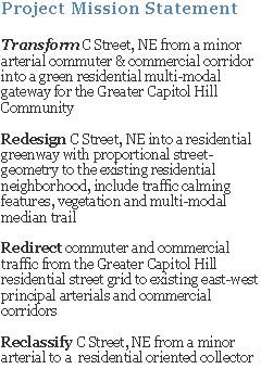
Here are the conceptual intersection designs, 21st & C Streets, 20th & C Streets, 19th & C Streets, 18th & C Street, 18th Pl & C Street, 17th & C Streets, 17th Pl & C Streetand 16th & C Streets, to transform C Street, NE into "Green, Residential, Multi-modal Gateway for the Greater Capitol Hill Community."
Thursday, January 8, 2009, 8AM - Westbound Traffic @ C & 21st Streets, NE Intersection (looking West)
Notice in the center background Eliot-Hines JHS. Morning commuter and commercial traffic not only effect residents quality-of-life, but students' safety to and from school (refer HERE to view DDOT vehicle speed counts). Currently, C Street, from 21st to 16th Street, is approximately 90ft wide (C Street's existing conditions), creating a grand hazardous divide between the Rosedale and Kingman Park neighborhoods and Eliot-Hines JHS and the Stadium-Armory Metrorail station.
“Architectural Blue Information Sign” (sign no. V10905) just west of 17th Street on the C Street median (East sign face, looking Northwest)
The above sign is great example of how DDOT views and treats C Street, NE (DDOT's current classification of C Street). For over two years we have unsuccessfully requested DDOT to revise the "local destinations" on this particular sign from "Downtown" to community based destinations, such as: "Eastern Market" and "Lincoln Park" (pointing toward North Carolina Ave) and "Stanton Park" (pointing straight on C Street). We also requested to have "Anacostia River Trail" added to the west sign face. The idea is to change C Street's image from a cut-through corridor to reach downtown, to a residential greenway connecting the Greater Capitol Hill community to its natural resources. Read more about C Street, NE Project's Objectives HERE.
Thursday, January 8, 2009, 8AM - Westbound Traffic @ C & 21st Streets, NE Intersection (looking East)
Nearly 10,000 daily morning commuter and commercial motorists (DDOT's vehicle counts) know C Street, NE, and the subsequent GCHSG, is one of the best paths-of-least-resistance roads between I-295/Kenilworth Ave and downtown during morning rush-hours (approximately between 6AM - 9AM). Refer HERE and HERE for more maps and information on C Street's traffic impact on Greater Capitol Hill community
Lastly, we would like to thank Allan Fye, DDOT Transportation Planner, for taking the time to walk C Street, NE from 21st to 16th Streets for almost a 1-1/2 hours in the cold to see, smell, hear and even taste the effects of C Street's morning rush-hour traffic. We look forward to working with him and continuing to work with the DDOT team to transform C Street, NE into "Green, Residential, Multi-modal Gateway for the Greater Capitol Hill Community."
Wednesday, January 07, 2009
Rescheduled C Street, NE Site Visit with DDOT
The scheduled Monday morning C Street, NE site visit has been rescheduled for tomorrow morning
What: C Street, NE site visit with DDOT Transportation Planner Mr. Allan Fye
When: January 5, 2009 @ 7:30AM
Where: Northeast Corner of C Street and 17th Place, NE
Why: To view morning rush-hours traffic conditions with DDOT and discuss how it not only negatively impacts the residents of C Street, but the Greater Capitol Hill neighborhood and community.
Mr. Allen Fye, DDOT Transportation Planner, recently filled, what was, the Ward 6 Transportation Planner position formerly held by Mr. Chris Delfs (it appears DDOT Transportation Policy and Planning Administration has restructured the planning department from wards to regions). He proactive contacted us requesting to familiarize himself with the C Street, NE current conditions and the proposed objectives.
Hope to see you there!
Ken Granata
Subscribe to:
Posts (Atom)