Thursday, March 26, 2009

DDOT's Chief Engineer Penney on the 11th St. Brigde Project

The below article has been excerpted, in its entirety, from the February 2009 Hill Rag's "the last word", Pages 155 and 156.(Note: highlights, bold-text and [text] have been added)


The successful completion of the 11th Street Bridge Project has the potential to redirect 1,000s of commercial and commuter vehicles from the Greater Capitol Hill Neighborhood Street Grid (GCHNSG), including C Street, NE!

C Street, NE and subsequent residential streets carry nearly 20,000 west-bound vehicles, most out-of-district commercial and commuter motorists, each weekday. Constructing the new 11th Street Bridge, with the I-295/Kenilworth Ave. and I-395/East-west Freeway connection, is essential to redirecting regional-commuter and downtown-destined vehicles, currently using C Street, to appropriate and designated routes. The solution to redirect these vehicles is two-fold, first make it “more appealing” to use the existing freeways infrastructure by creating an uninterrupted connection between the two existing freeways, and second, making it “less appealing” to use the GCHRSG by placing strategic neighborhood scaled traffic-calming devices to make it difficult to traverse the GCHRSG from I-295/Kenilworth Ave to either downtown or I-395/East-west Freeway.

Without this important piece of the transportation puzzle, our community will continue to resort to using "bubble-gum fixes" in a feudal attempt to restrict and manage the overwhelming current traffic volumes flowing through the Greater Capitol Hill Community and never fully realize Capitol Hill's potential as a "livable, walkable community".

Also, WashCycle refers to the DC Chief Engineer's editorial in a recent post, HERE, discussing the proposed 11th Street Bridge project from a cyclist perspective.

For more on the project...

HERE is the February 2009 "Waterfront Watch" newsletter, published by the Anacostia Waterfront Civic Engagement Program, which includes reference to Kathleen Penney's Hill Rag article.

Below is a DDOT newsletter, from July 2008, providing general project goals and design objectives.


(click on image for a larger view)


(click on image for a larger view)


HERE is a link to DDOT/Anacostia Water Initiative’s 11th Street Bridge Project website

Greater, Greater Washington blog has a 3 part series discussion on the project, Part 1, Part 2 and Part 3.

Wednesday, March 25, 2009

Traffic Calming Measures in Mayor's 2010 Proposed Budget

Below are a few excerpts from a Washington Post article today, read the full article HERE, about some of Mayor Fenty's proposed revenue generating items to balance the 2010 budget. Some of these items are geared towards motorists who violate current city vehicular traffic laws. C Street, NE is a great place for some of the proposed items, if implemented; especially, over-weight trucks and motorists who accelerate through yellow signal-lights.


(click to view larger version, highlights have been added)


(click to view larger version, highlights have been added)

Tuesday, March 24, 2009

2008 & 2009 National Marathon Photos

Below are a few photos of the 2009 and 2008 National Marathon along the 1700 block of C Street, NE.

Once a year, C Street residents enjoy a peaceful weekend morning without roaring truck and car traffic. Instead, the faint, muffled pitter-patter of running shoes on worn-out asphalt. Bliss!


2009 National Marathon Sign


2009 - 1700 Block of C Street, NE - Looking West


2009 - 1800 Block of C Street, NE - Looking East


2008 - 1700 Block of C Street, NE - Looking West

Monday, March 16, 2009

Request to Revise C Street, NE 'Local Destination Sign'

A DC Service Request, see request below, has been submitted to revise the existing blue 'local destination sign', sign no. V10905, on the C Street, NE median just west of 17th Street. Note: currently this sign is directed towards motorist, not pedestrians or cyclists.


DC Service Request #2057886

The service request, submitted to DDOT, is to revise/update the 'local destinations' from "Downtown" (east sign face) to community based destinations, such as: "Eastern Market" and "Lincoln Park" (pointing toward North Carolina Ave) and "Stanton Park" (pointing straight on C Street). The service requested also recommends adding "Anacostia Riverwalk Trail" to the west sign face.


Existing East Sign Face (Arrow points towards North Carolina Ave and Lincoln Park)

The idea is to change C Street's image, and subsequent neighborhood streets, from a cut-through corridor to reach downtown, to a residential greenway connecting the Greater Capitol Hill community to it's great outdoor spaces.

Update: Allan Fye DDOT Transportation Planner, Transportation Policy and Planning Administration, spoke with DDOT's Lewis Booker, who manages the 'local destination sign' program (those architectural blue information signs), about the above request and Mr. Lewis stated he is personally working with the contractor to get the sign updated. Mr. Lewis is currently working with the sign contractor to update the downtown pedestrian directed blue local destination signs and then will begin updating the motorist directed signs.

Wednesday, March 11, 2009

WashCycle Discusses the Multi-modal Trail Designs


The WashCycle blog has discussed HERE and HERE the C Street, NE Project's conceptual raised-median trail and DDOT's suggested bike-lane configuration from the perspective of bicyclists.

Though the C Street, NE Project's "multi-model trail" would be geared towards, cyclists, roller-bladers, joggers/runners and walkers, the perspective of safety and mobility (uninterrupted travelling speeds) are worth consideration. The goal of the multi-modal trail, in essence, would be to extend the recently completed portion of Anacostia Riverwalk Trail (ART), which has a terminal at C & 21st Streets, NE., into the Capitol Hill community. This allows users a safer connection between their neighborhood and outdoor recreation spaces, such as ART, Kingman and Heritage Islands, Lincoln Park and Stanton Parks, Eastern Market, Langston Golf Course; and maybe someday, other destinations like the Aquatic Gardens and the Arboretum.


DDOT's Interim Anacostia Riverwalk Trail (ART) Map

Below are two excerpted images from NYC Department of Transportation Traffic Management Division, 2009 Boulevard Pilot Project, for Allen & Pike Streets referenced in WashCycle's post.


Interim Test Treatment
The above interim test treatment provides a living “vision” of what could be by testing the feasibility of closing certain cross street intersections, creating uninterrupted connections between the existing "Malls" (median segments) and using limited investment capital.


Long Term Conceptual Design
The above "Long-term Vision" of the existing median, "Malls doubled in width creating grand, Parisian-style linear greenway and community space".

Though the above median concept design is for a high-density, commercial and residential boulevard, the intent is the same, safely connect the community to it's outdoor spaces, provide open green spaces and reduce vehicular impact on the community. Image C Street, NE with a similar role for the community, it really isn't that hard.

Part of C Street, NE Project's conceptual raised-median trail design is to reduce one intersection, 18th Street (refer HERE), and employ "all-stop" intersections at the remaining vehicular crossing intersections (21st, 19th, 17th, 15th and 14th/Constitution Ave) to allow pedestrians to move in, out and along the trail. The traffic-signals could be sequences to assist in maintaining cyclist "flow" while travelling along the trail.

Thanks to WashCycle for picking-up and discussing the trail/path and David C. for the tips.

Thursday, February 26, 2009

CHRS Files Suit Against DDOT's 11th St. Bridge Project

Below is a Capitol Hill Restoration Society (CHRS) press-release for distribution:


(click on image for a larger view)

Here is CHRS website for further information. CHRS has quite a bit of information about the project, HERE, including the organization's views of how the project may or may not impact the Greater Capitol Hill Community.

Below is a DDOT newsletter, from July 2008, providing general project goals and design objectives.


(click on image for a larger view)

(click on image for a larger view)


HERE is a link to DDOT/Anacostia Water Initiative’s 11th Street Bridge Project website

Greater, Greater Washington blog has a 3 part series discussion on the project, Part 1, Part 2 and Part 3.


~ Thank you Jeff F. for the tip.

Monday, February 23, 2009

CM Wells' Supports C Street, NE Lane Reduction!


(click on letter for larger view)

Above is a letter, dated 12/22/08, from Ward 6 Council Member Tommy Wells to Interim DDOT Director Frank Seales urging DDOT to reduce the number of C Street, NE west-bound lanes from 3 to 2 immediately after the Benning Road Reconstruction Project is completed.

CM Wells has been supportive of our efforts for years, making his first site visit to C Street, NE back in April 2007 to listen to residents safety and quality-of-life issues related to commuter and commercial traffic volumes, vehicular speeds and poor residential street geometry.

In his letter (above), Wells states, "Residents and community groups, including the Rosedale Citizens’ Alliance, believe the first step to addressing this [C Street, NE] commuter corridor is reducing the number of west-bound lanes between 21st and 16th Streets NE from three vehicular lanes to two. I concur."


(Conceptual C Street, NE West-bound Lane Reduction, click on image for larger view)

HERE is our concept to close one of the 3 west-bound C Street, NE lanes. The idea is to make it less appealing to use C Street as a commercial and commuter cut-through corridor and dispersing these vehicles into the Greater Capitol Hill neighborhood street grid and make it more appealing to use existing east-west major-arterial commercial corridors that directly connect Kennilworth Ave/I-295 and point east to downtown. These major-arterials include: Benning/H Street, New York Ave, Pennsylvania Ave, proposed 11th Street Bridge (I-295/I-395 connection) and M Street, SE.

Also, to encourage out-of-district commuters to use existing under-utilized mass-transit systems, such as the Stadium/Armory Metro Station. Another alternative is for DC Government to consider providing reduced or free RFK Stadium vehicle parking for motorist using the metro-rail or metro-bus system.

In the letter, CM Wells goes on to state, "I urge DDOT to begin designing this new reduced-lane configuration so that it may be implemented once the Benning Road project is complete." Currently, the Benning Road Reconstruction Project is scheduled to be completed by December 2009. So, we would like the lane reduction to be implemented in January/February 2010. That gives DDOT a 12-14 month design and implementation period from the dated letter.

A HUGE thank you to CM Tommy Wells and his staff for their continuous time, support and attention to our efforts. We are very fortunate to have a representative like CM Wells who, not only embraces the value of a "livable, walkable community", but is in the forefront leading the community and DC government to ensure such a noble cause move towards realization.

Lastly, below is the letter RCA's Transportation Committee sent to CM Tommy Wells on November 21, 2008 requesting CM Wells send a letter of support to DDOT Interim Director Frank Seals.

Tuesday, February 17, 2009

WAMU 88.5 Interview about C Street, NE Project

Ms. Eilis O'Neill with WAMU 88.5 FM, American University Radio, contacted me to do a interview about the C Street, NE Project. She discovered the blog via Greater Greater Washington's post about our efforts. The 'walking' interview was conducted along C Street, between 17th Place and 21st Street, last Wednesday, February 11, 2009 from 8:30-9AM. It aired yesterday, February 16, 2009, at 6:30AM and again at 8:30AM.

I would like to personally thank Ms. O'Neill for considering the project, taking the time to contact and interview me and highlighting the project's goals and objectives.

Click HERE to go to WAMU's website, you will have to click either 'Real Audio' or 'Windows Media' in order to listen to the interview, it is 1m:27s long.


Ken Granata

Monday, February 09, 2009

C Street, NE Project Blog Recognized by Greater, Greater Washington


A BIG thanks to David Alpert of Greater, Greater Washington for writing a really nice exposure post, "Positive resident activism: C Street, NE" (dated: February 5, 2009),on the efforts of the C Street, NE Project blog. We not only appreciate the exposure, but his perspective of "positive activism".


Wednesday, January 28, 2009

Potential C Street, NE Bike Lane Designs

Allen Fye, DDOT Transportation Planner, reviewed the conceptual C street, NE raised center median path proposed on this site, see examples HERE, HERE and HERE. He offered an alternative design layout, physically separated bike lane, to consider as DDOT moves forward with creating C Street, NE Project's feasibility study scope.


The above street cross-section is one type of bike lane configuration DDOT is considering as the DC creates a more city-wide bicycle-friendly infrastructure. This section would not necessarily be a direct application to C Street, NE. This type of configuration is more suited for commercial, high-density opposed to residential medium density. In short, asymmetrical to symmetrical layouts. Also, the example section is approximately 65ft wide (sidewalk curb to sidewalk curb) and C Street is approximately 90ft wide.

Refer to the post, "NYC Gets Its First-Ever Physically-Separated Bike Path" on StreetsBlog dated 09/20/07 for more information on this type of bike-lane configuration.

Below are several items Allan considers beneficial to the above street-scape cross-section:

1. You don’t have to cross traffic to enter a median bike path.

o This [raised center median path] would require having to retime the signals in the corridor to provide bike/ped only time to cross into the center median bike path.
o This [crossing traffic lanes to enter a raised center median path] could also raise serious safety issues.
o It [physically separated bike lane] would also be able to tie in easier to the Anacostia Trail by either continuing on the same side or only crossing C St NE once.

2. Safety would be increased since:

o you would not be in between two directions of traffic [raised center median path scenario]
o the street layout [physically separated bike lane] would be grade separated and protected by a line of parked cars. (sidewalk, planted strip, bike path, planted strip, parking lane, two lanes of traffic, planted median, two lanes of traffic, parking lane, bike path, sidewalk) This is just one potential layout of the right-of-way.

3. Being in between two directions of traffic would expose bikers/pedestrians to heavier amounts of noise and exhaust. [raised center median path scenario]

4. This is more in line with bike path planning and trends around the world and potentially in DC. [physically separated bike lane]

Please post your thoughts on either a "raised center median path", a " physically separated path" or some other potential design. Consider a design layout that would essentially connect and extend the recently constructed Anacostia River Trail (ART) at the northeast corner of C & 21st Street, NE.

Thursday, January 22, 2009

Update: 17th & 19th Streets Conversion to Two-way Operations

Allan Fye, DDOT Transportation Planner, sent an update regarding the conversion of 17th & 19th Streets to two-way operations.

"The design work for the [17th & 19th Streets] conversion is in the TIP (Transportation Improvement Plan) for 2010. The project will require developing the process to convert the streets to two way traffic, including restriping, signage, signal timing, etc. This list is not exhaustive (as I am not an engineer). I will be in touch as soon as I make some more progress on the scope of work for the study."

Here is the link to the Capitol Transportation Study Draft Final Report discussing the analysis of the two-way conversions, which includes 17th & 19th Streets.

This is great news for all those who have repeatedly requested this information from DDOT. Once again, a BIG thank you to Allan Fye (allan.fye@dc.gov) for proactively tracking down this information and dissemiating it to the public.

Friday, January 09, 2009

DDOT C Street, NE 01/08/09 Site Visit Photographs


Thursday, January 8, 2009 @ 8AM - Westbound Traffic @ C & 17th Streets, NE Intersection (looking East)


Thursday, January 8, 2009 @ 8AM - Westbound Traffic @ C & 19th Streets, NE Intersection (looking East)

Two Above Photographs

Notice (1) 3 traffic lanes bumper-to-bumper all the way to the background horizon line (well beyond 21st Street intersection to the C & East Capitol Street split @ RFK Stadium) and (2) no east-bound vehicles, this clearly indicates the overwhelming morning rush-hours traffic volume (DDOT traffic volume counts) coming into and through the North portion of Capitol Hill (DDOT's Capitol Hill Transportation Study)

Click HERE to view and read our proposal for DDOT to remove (reduce) 1 west-bound traffic lane to constrict, and attempt to deter, out-of-district commuters from using C street and the subsequent Greater Capitol Hill Neighborhood Street Grid (GCHSG) to reach downtown destinations. Ward 6 CM Wells supports our proposal and has sent a letter to DDOT Interim Director Frank Seales requesting the lane reduction immediately following the completion of the Benning Road Reconstruction Project.

Here are the conceptual intersection designs, 21st & C Streets, 20th & C Streets, 19th & C Streets, 18th & C Street, 18th Pl & C Street, 17th & C Streets, 17th Pl & C Streetand 16th & C Streets, to transform C Street, NE into "Green, Residential, Multi-modal Gateway for the Greater Capitol Hill Community."


Thursday, January 8, 2009, 8AM - Westbound Traffic @ C & 21st Streets, NE Intersection (looking West)

Notice in the center background Eliot-Hines JHS. Morning commuter and commercial traffic not only effect residents quality-of-life, but students' safety to and from school (refer HERE to view DDOT vehicle speed counts). Currently, C Street, from 21st to 16th Street, is approximately 90ft wide (C Street's existing conditions), creating a grand hazardous divide between the Rosedale and Kingman Park neighborhoods and Eliot-Hines JHS and the Stadium-Armory Metrorail station.


“Architectural Blue Information Sign” (sign no. V10905) just west of 17th Street on the C Street median (East sign face, looking Northwest)

The above sign is great example of how DDOT views and treats C Street, NE (DDOT's current classification of C Street). For over two years we have unsuccessfully requested DDOT to revise the "local destinations" on this particular sign from "Downtown" to community based destinations, such as: "Eastern Market" and "Lincoln Park" (pointing toward North Carolina Ave) and "Stanton Park" (pointing straight on C Street). We also requested to have "Anacostia River Trail" added to the west sign face. The idea is to change C Street's image from a cut-through corridor to reach downtown, to a residential greenway connecting the Greater Capitol Hill community to its natural resources. Read more about C Street, NE Project's Objectives HERE.


Thursday, January 8, 2009, 8AM - Westbound Traffic @ C & 21st Streets, NE Intersection (looking East)

Nearly 10,000 daily morning commuter and commercial motorists (DDOT's vehicle counts) know C Street, NE, and the subsequent GCHSG, is one of the best paths-of-least-resistance roads between I-295/Kenilworth Ave and downtown during morning rush-hours (approximately between 6AM - 9AM). Refer HERE and HERE for more maps and information on C Street's traffic impact on Greater Capitol Hill community


Lastly, we would like to thank Allan Fye, DDOT Transportation Planner, for taking the time to walk C Street, NE from 21st to 16th Streets for almost a 1-1/2 hours in the cold to see, smell, hear and even taste the effects of C Street's morning rush-hour traffic. We look forward to working with him and continuing to work with the DDOT team to transform C Street, NE into "Green, Residential, Multi-modal Gateway for the Greater Capitol Hill Community."

Wednesday, January 07, 2009

Rescheduled C Street, NE Site Visit with DDOT

The scheduled Monday morning C Street, NE site visit has been rescheduled for tomorrow morning

What: C Street, NE site visit with DDOT Transportation Planner Mr. Allan Fye

When: January 5, 2009 @ 7:30AM

Where: Northeast Corner of C Street and 17th Place, NE

Why: To view morning rush-hours traffic conditions with DDOT and discuss how it not only negatively impacts the residents of C Street, but the Greater Capitol Hill neighborhood and community.

Mr. Allen Fye, DDOT Transportation Planner, recently filled, what was, the Ward 6 Transportation Planner position formerly held by Mr. Chris Delfs (it appears DDOT Transportation Policy and Planning Administration has restructured the planning department from wards to regions). He proactive contacted us requesting to familiarize himself with the C Street, NE current conditions and the proposed objectives.

Hope to see you there!

Ken Granata

Wednesday, December 31, 2008

C Street, NE Site Visit with DDOT

Join Us!

What: C Street, NE site visit with DDOT Transportation Planner Mr. Allan Fye

When: January 5, 2009 @ 7:30AM

Where: Northeast Corner of C Street and 17th Place, NE

Why: To view and discuss morning rush-hours traffic conditions with DDOT

Mr. Allen Fye, DDOT Transportation Planner, recently filled, what was, the Ward 6 Transportation Planner position formerly held by Mr. Chris Delfs (it appears DDOT Transportation Policy and Planning Administration has restructed the planning department from wards to regions). He proactive contacted us requesting to familiarize himself with the C Street, NE current conditions and the proposed objectives.

Hope to see you there!

Ken Granata

Welcome to the C Street, NE Project Blog!

Welcome to the C Street, NE Project Blog!

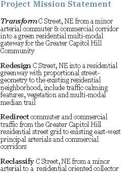
This blog was created to collectively gather citizen, civic-representative and civil-servant support to transform C street, NE, from 21st Street to 16th Street, from a minor arterial commuter & commercial corridor into a green, residential gateway for the Greater Capitol Hill community.


C Street, NE Project Manifesto

1. Provide a central location to disseminate and access timely C Street, NE related information and resources
2. Create a community forum to discuss current C Street, NE problems and consider future solutions
3. Build and maintain support and momentum for permanent, positive changes for C Street, NE during the next scheduled reconstruction project


Thank you for visiting the site,

Ken Granata


PS… one suggestion, use the "Blog Archive" bar on the lower right portion of the site to readily access relevant information. Because there is so much supporting information and the limitation of this blog structure, a variety of existing and proposed data has been organized as individual posts, refer to the below example:

Tuesday, December 30, 2008

Interim Remediation - Remove 1 West-bound C Street Vehicular Lane

We are currently lobbying DDOT to remove one west-bound C Street, NE immediately after the Benning Road Reconstruction Project is complete (secheduled completion date is currently 12/09). CM Tommy Wells has agreed to this proposal and has sent a support letter, at the request of the RCA Transportation Committee, to DDOT Interim Director Frank Seales on December 22, 2008. A copy has been sent to RCA and will be posted once it is received.


Existing Condition


Proposed Condition

Monday, December 29, 2008

NCPC - RFK Stadium Site Study Vision for C Street, NE


Obviously, NCPC - RFK Stadium Site redevelopment Study is just that, a study. And, all concepts, layouts and visions for the large parcel are only conceptual to foster discussion of the site's potential as major destination for both residents and tourists.

But, I have to agree with the Study, Constitution Ave and Independence Ave (flanking East Capitol Street) should be reconstructed as the axial corridor connecting the monumental core to Capitol Hill East's Anacostia River shores. This moves the original DC layout much closer to its envisioned symmetry. Refer to the excerpted text below...


What is most exciting in NCPC's conceptual "Street Network", proposing C Street terminate at the edge of the site's green-space area and disconnect completely from East Capitol Street, as currently configured. Whether this vision is ever realized or not, directing downtown destined (or inversed, leaving downtown) vehicular traffic to use current major east-west commercial arterials (such as, Pennsylvania Ave, New York Ave and Benning RD/H Street) is vital to the health and safety of all Capitol Hill residents and visitors.

Tuesday, December 23, 2008

DDOT Planned C Street Construction Project on "Paper" Only


Extracted from DDOT's "Ward 6 Planned Construction Projects" website

Here is a potential opportunity to 'spring-board' the envisioned C Street, NE project into reality. From the beginning, we have urged DDOT Transportation Policy and Planning Administration to consider redesigning and constructing C Street during the next scheduled "pavement resurface/restoration" construction project. When that is actually schedule to take place is to be scene, though we have asked DDOT, but have not received an answer yet.

Existing and Proposed - C Street and 17th Place Intersection


Existing Condition


Proposed Design

Existing and Proposed - C and 16th Street Intersection


Existing Condition


Proposed Design