Monday, October 19, 2009

Cut-through Commuter & Commercial Motor-vehicle Traffic is a Chronic Systemic Capitol Hill Problem

It is time, we as a Greater Capitol Hill community, look at cut-through commuter and commercial motor-vehicle traffic as a chronic systemic problem. In order for our community to truly thrive as a livable, walkable and bikable village, we need to shift vehicular-traffic routes, for instance regional and city rush-hours, from the neighborhood street grid to existing principle arterials and commercial corridors. These motorist/vehicles create hostile, inhabitable environments throughout our community, from our parks and schools to our residential streets, and divide neighborhoods, making it treacherous for residents to access (walking, cycling or even driving) their own community amenities.


Excerpted DDOT 2006 Function Classification Map showing the Greater Capitol Hill region

Excerpted DDOT 2006 Function Classification Map Legend

The existing archaic hap-hazard network of residential streets used and/or designated to expedite and accommodate commuter and commercial traffic pits residents against commuters. We can efficiently, effectively and safely convey existing motor-vehicle traffic volumes in, out and around DC without compromising residents’ quality-of-life. It is possible to strike a balance between residents and visitors (workers, tourists, Fed. Gov., national events, etc.) to create and maintain a vibrant city both ‘users’ can enjoy. And realistically, it is a symbiotic relationship, the two user-types need each other to thrive.

So, how do we achieve such a righteous goal? We need to develop and systematically execute a consensus-based master plan with a definitive time-line.

The master plan should include:

1. Prioritize pedestrian and cyclist safety and enjoyment
2. Restore and improve existing parks and open-spaces, tree canopies and vegetative areas
3. Safely connect neighborhoods to public open-spaces, parks, schools and commercial corridors with minimal direct interaction with vehicular roadway traffic
4. Shift regional and city rush-hours vehicular traffic patterns/routes from the neighborhood street grid, and surrounding open-spaces, to existing designated principle arterials and commercial corridors
5. Educate and condition motorists (commuters, tourists, commercial-drivers) to the benefits of using designated routes to either access downtown or regional freeway infrastructure
6. Fund maintenance of existing mass-transit infrastructure and heavily invest in capitol improvement projects that enhance access to our existing mass-transit, walking and cycling systems.

Ward 6 has all the pieces to begin and follow-through with such a transformation...

• Residents' Support - indirect and direct through lifestyle & activism
• Leadership – folks like Council Member Tommy Wells who is a leader in the DC urban movement and DDOT Director Gabe Klein who is reprioritizing DDOT to focus on mass-transit and residents’ desire for pedestrian and cyclist oriented streets and neighborhoods
• Existing Transportation Infrastructure - Anacostia Riverwalk Trail, Stadium/Armory, Eastern, Potomac and Union Station Metrorail Stations, Future H Street/Benning Road Streetcar, bicycle lanes, metro-bus routes, DC/I-295, I-395 and the Anacostia River
• Existing Natural & Planned Outdoor/Open-spaces - Stanton Park, Lincoln Park, Anacostia River and waterfront, Kingman & Heritage Islands, Langston Golf Course, Steward Park, Garfield Park, National Mall, etc.
• Amenities - acces to Barracks Row, Eastern Market, H Street/Benning Road Corridor, Union Station, Pennsylvania Ave Corridor, etc

The key to our success is redirecting commuter and commercial vehicle/motorist cut-through traffic onto existing principle arterials and commercial corridors. Make it less appealing to use the Greater Capitol Hill neighborhood street grid and make it more appealing to use existing east-west principle arterials and commercial corridors.

The below map indicates existing east-west oriented principle and minor arterial roads (in red), which are primarily commercial corridors and interstates, that could carry a majority of the existing volume of commuter and commercial motor-vehicle traffic traversing in and out of downtown and regional traffic traveling to destination beyond city limits. As the map indicates, using these existing roadways, large residential areas could be spared and relieved of the vast majority of the daily cut-through motor-vehicle traffic.


Let's discuss it and move forward together; we can definitely achieve a great balance within a few years! Policy, advocacy, education, design, implementation and maintenance (actually, continual improvements) collectively can create a truly livable, walkable, bikable community for Ward 6.

Thoughts? Ideas? Comments? ...let me know,

Ken G.
cstreetneproject@gmail.com
C Street, NE Project

Tuesday, October 06, 2009

ANC6A Supports Permanent Speed-camera on C Street, NE


Full Letter sent to MPD Home Land Security Chief Patrick Burke


Excerpted Body of the Letter (click on image to read larger version)

As the above letter states, since the west-bound C Street, NE mobile speed-camera's inception, December 1, 2007, until June 10, 2009 there have been:

13,246* vehicular speeding citations issued by MPD!

Average per month: 716 citations
Average per day: 23 citations

Note - the MPD mobile speed-camera is only periodically deployed during the week and rarely deployed on the weekends. Additionally, it is deployed only in the west-bound vehicle travel lanes, with no east-bound enforcement for motorist accelerating toward RFK stadium and the Whitney-Young Bridge (East Capitol Street).

A HUGE "thank you" to the ANC6A Public Safety Committee and all the ANC 6A Commissioners, especially SMD6A08 Commissioner Kelvin Robinson and Rebecca Sibilia, for recognizing the importance of resident and student safety along this portion of C Street, NE.


*Data was requested from and provided by Sergeant Mark Robinson - MPD, Homeland Security Bureau, Traffic Safety & Specialized Enforcement Branch.

Wednesday, September 23, 2009

Imagine C Street, NE as a Greenway!

Below are great reasons for greenway trails, much like what we are proposing for C Street, NE. Greenways safely connect residents to outdoor natural amenities. In our case, places like: Langston Golf Course, Anacostia Riverwalk Trail, Kingman & Heritage Islands, the future Environmental Educational Center and Memorial Tree Grove for 9/11 DC schoolchildren victims (on Kingman & Heritage Islands), National Arboretum, Kenilworth Park, Aquatic Gardens, and Marsh and local neighborhood amenities, such as: Eastern Market and the H Street/Benning Road commercial corridor. And why not consider schools too, specifically: Eliot-Hines JHS, Eastern HS and Maury ES.


The text and images below are from New York City's Department of Parks & Recreation Bicycling & Greenway website.


Why Greenways?
A greenway is a linear open space, such as a path or trail, which links parks and communities around the City, providing public access to green spaces and the waterfront. Greenways expand recreational opportunities for walking, jogging, biking, and in-line skating.

In 1993, the City of New York had a vision to create 350 miles of landscaped bicycle and pedestrian paths that would crisscross the City's five boroughs and enrich the lives of all New Yorkers. Currently Parks has built over 100 miles of the proposed greenway system. Greenways answer the growing public demand for safe and pleasant ways to travel about the City. These trails allow one to get to work or school, shop or do errands, or to reach the waterfront, parks, beaches, and museums.


Benefits of Greenways
Cyclists, joggers, strollers, skaters, people in wheelchairs or who are mobility-impaired, dog walkers, bird watchers, kids and adults, families and friends, recreational users and commuters—in short, everyone and anyone—gain from the presence and production of greenways. As levels of obesity and diabetes rise among our population, the need to stay fit and healthy has never been more urgent. In order to ensure that no one has to travel too far to use an athletic facility, we are constantly looking to add new properties where parkland previously did not exist and when that is not possible, to bring people to existing facilities.

For Health
Using greenways helps keep you healthy. By bicycle riding, walking, jogging, or skating on the greenways, you can get exercise in an enjoyable way and spend time outdoors!

For Transportation
Riding a bicycle is a form of exercise, recreation, and transportation. Try bicycle riding for your daily commute and see how favorably it compares to driving a car, riding the bus, or taking the subway. Bicycles often get you there in less time, and the scenery is better! It's good for you AND the environment.

For the Environment
The fewer cars we drive and the fewer car trips we make, the cleaner our air becomes. Bicycles and skates don't pollute! By choosing to bike, you will reduce automobile congestion and pollution, thus improving the quality of life in our city. The City's environmental health is also improved because trees are planted along the City's greenways.

For Safety
Designated bicycle paths are excellent places to learn how to ride! Riding on designated bicycle paths is safer than riding on unsigned streets and roads.

For Fun
Greenways are fun! Skate and enjoy time with friends or family, walk to the playground, bike with your children… Trees and plants along greenways make using these paths a relaxing escape from the asphalt jungle. Rediscover New York City's parks, rivers, harbors, and bays! You will see natural landscapes and amazing city views missed by most drivers.

Tuesday, September 22, 2009

VOH: Residents push for permanent C St. speed camera


Residents push for permanent C St. speed camera
September 21, 2009

By the Voice

The Rosedale Citizens Alliance, with the support of Ward 6 D.C. Council member Tommy Wells, is asking the Metropolitan Police Department to make permanent a temporary speed camera on C Street NE.

The police department has been operating a mobile speed camera at C and 18th streets since December 2007. Since then, 13,246 tickets have been issued to westbound vehicles.

“I believe this number provides justification for installing a permanent speed camera at this location, particularly since the mobile camera only operates for limited periods of time,” Wells wrote in an August letter to the police department.

The citizens alliance has been advocating for better enforcement of the 25-mph speed limit at the intersection, emphasizing its proximity to Eliot-Hine Middle School.


Note: The above article and logo were extracted in its entirety from VOH website.

Tuesday, September 01, 2009

Wells Supports Permanent Speed-camera on C Street, NE!


Full Letter sent to MPD Home Land Security Chief Patrick Burke


Excerpted Body of the Letter (click on image to read larger version)

As the above letter states, since the west-bound C Street, NE mobile speed-camera's inception, December 1, 2007, until June 10, 2009 there have been:

13,246* vehicular speeding citations issued by MPD!

Average per month: 716 citations
Average per day: 23 citations

Note
- the MPD mobile speed-camera is only periodically deployed during the week and rarely deployed on the weekends. Additionally, it is deployed only in the west-bound vehicle travel lanes, with no east-bound enforcement for motorist accelerating toward RFK stadium and the Whitney-Young Bridge (East Capitol Street).

HERE are two previous posts on existing vehicle speeds and MPD's mobile speed-camera.

Another Big "thanks" to Council Member Wells and his staff, especially Chief-of-Staff Charles Allen and Smart Growth & Transportation Policy Advisor Anne Phelps, for recognizing the importance of resident and student safety along this portion of C Street, NE.


*Data was requested from and provided by Sergeant Mark Robinson - MPD, Homeland Security Bureau, Traffic Safety & Specialized Enforcement Branch.

Wells Supports Prohibiting Commercial Trucks & Buses on C Street, NE


Full Letter sent to DDOT Director Gabe Klein & DDOT Ward 6 Planner Jamie Henson


Excerpted Body of the Letter (click on image to read larger version)

Commercial vehicles using C Street, NE, beginning at 21st Street, are a serious chronic safety, health and quality-of-life issue for C Street residents, students attending Eliot-Hine JHS, youth using the school’s outdoor courts and fields and residents commuting to and from the Stadium/Armory Metrorail station. Not to mention, 'downstream' Capitol Hill residents and open-spaces, such as, Lincoln Park, Eastern Market and Stanton Park.

A majority of these commercial vehicles, especially motor-coaches and mid- and large-sized delivery trucks, use the Capitol Hill neighborhood street grid to either move in and out of downtown or connect between I-295/Kenilworth Ave and I-395/East-west Freeway.

So, the purpose of the above letter, dated August 20, 2009, is to urge the District of Columbia's Department of Transportation (DDOT) to prohibit commercial vehicles (trucks and motor-coaches), with a GVW greater than 1-1/4 tons, from using C Street, NE, between 21st and 6th Streets. This in part, is to begin redirecting commercial traffic from the residential street grid to existing east-west major arterial and commercial routes recommended in the DDOT’s “2004 District of Columbia Motor Carrier Management and Threat Assessment Study”.

Also, as referenced in the above letter, HERE is Tommy Wells' letter to DDOT requesting the reduction of one west-bound C street lane.

Once again, a BIG "thank you!" to Council Member Tommy Wells and his staff for their continuous time, support and attention to our efforts. We are very fortunate to have a representative like CM Wells who, not only embraces the value of a "livable, walkable community", but is in the forefront leading the community and DC government to ensure such a noble cause move towards realization.

Thursday, August 13, 2009

Update on Service Request to Improve C & 19th Street Lot

First step, the saplings have been cut down! Second step, remove 'jersey barriers' and replace with wood bollards.

Thanks to City staff for their quick efforts to begin addressing this service request (2183466). It appears this was done around 08/07/09, just 30 days from the service request submission. It's assumed it is a joint effort between Department of Works and Co-Ward 6 Outreach & Service Specialists Forest Hayes and Chris Taylor with the Executive Office of the Mayor.


Before: Sapling Refuge Amongst 'Jersey Barriers'


After: Saplings Removed, Revealing Ugly 'Jersey Barriers' (apology for the poor quality camera-phone photo)

Friday, August 07, 2009

Request to Improve C Street, NE Pedestrian Safety

Pedestrians crossing the 90ft wide (curb-to-curb) C street, NE "great divide" at the 17th & 19th Streets intersections are in a dangerous and hazardous duel with motor-vehicles turning from 17th and 19th Streets on to C Street, NE. Because of the vast distance pedestrians traverse, and the large vehicle turning movement, motorist and pedestrian chronically are dueling for the same space while navigating C Street.

The long term solution would be to greatly decreasing the distance a pedestrian is in the roadway (reducing vehicle lanes, create intersection bulb-outs, increase median width) and provide all stop intersections to allow pedestrians, cyclists, roller-bladers, etc. to move through the intersection without "competing" for space/time with motorists.


Service Request 1985543


17th & C Street, NE Intersection (looking south)


Service Request 1985540


19th & C Street, NE Intersection (looking north)

Thursday, July 16, 2009

Requests to Improve C & 19th Street, NE Vacant Lot

Two service requests have been submitted through DC's Service Request Center to improve site conditions along C Street, NE in front of a vacant lot near the corner of C & 19th St. The vacant lot is Federally owned.

As the pictures indicate, the vacant lot is well maintained except for the area at the existing C Street driveway apron. Jersey barriers have been placed to block the driveway and vegetation, more like tree saplings, have taken harbor and refuge. Missing sidewalks flank either side of the existing driveway apron; there is only a grassy and a rocky pathway as a dangerous substitute. Not including the asphalt driveway apron, approximately 60ft of sidewalk is missing.

1. Service Request 2183466 - Jersey Barriers & Vegetation Overgrowth
a. Remove vegetation overgrowth
b. Remove barriers and replace with wood bollards


2. Service Request 2193772 - Missing sidewalk
a. Replace approximately 60ft of missing concrete sidewalk


Updates will be posted to track progress.

Saturday, June 13, 2009

C Street, NE Update: 13,246 Speeding Citations Issued!

Since the west-bound C Street, NE mobile speed-camera's inception, December 1, 2007, until June 10, 2009 there have been:

13,246* vehicular speeding citations issued by MPD!

Average per month: 716 citations
Average per day: 23 citations


We believe the above figure validates a request to erect a permanent speed-camera, in the same vicinity as the mobile speed camera (18th & C Streets, NE), to enforce the 25 MPH speed-limit in both the east- AND west-bound vehicular lanes.

C Street, NE, from Oklahoma Ave (21st Street) to 15th Street, is completely residential and includes Eliot-Hines Junior HS school-zone, (between 19th St and 17th Place). It is also an approximately 90ft wide (7 lanes with parking) asphalt void, dividing the Rosedale and Kingman Park's residents from Eliot-Hines JHS and grounds and service souths, such as, the Stadium-Armory Metrorail Station.

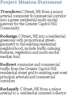
Please join RCA’s Transportation Committee at this week's ANC6A Public Safety Committee meeting - Sherwood Recreation Center (corner of 10th and G Street NE) - on Thursday evening, June 18 @ 7pm, as we conduct a brief presentation and discussion on C Street’s dangerous existing conditions and propose some design ideas on how to transform C Street, NE from a minor arterial commuter & commercial corridor into a safer, green, residential, multi-modal gateway for the Greater Capitol Hill Community.

RCA will also request ANC6A support 3 major transportation and safety initiatives:

1. Reduce at least one west-bound vehicular lane (3 to 2 lanes)
2. Erect a permanent speed-camera to enforce the 25MPH speed limit along the east- AND west-bound vehicular lanes
3. Prohibiting motor-coaches and commercial vehicles > 1-1/2 tons G.V.W.


*Data was requested from and provided by Sergeant Mark Robinson - MPD, Homeland Security Bureau, Traffic Safety & Specialized Enforcement Branch.

Monday, April 27, 2009

11th Street Bridge Project Contractor Selected

Fenty Administration Moves Forward with Work on 9th and 11th Streets Bridge Projects

Contractor Selected on 11th Street Bridges

Today, Mayor Adrian M. Fenty and District Department of Transportation (DDOT) Director Gabe Klein announced the significant work that is set to begin on the 9th Street Bridge (NE) and the 11th Street Bridges (SE) projects.

“These projects are a huge undertaking that will provide safer and more efficient roads for local and commuter traffic,” said Mayor Fenty. “The results will spur economic development opportunities in Brentwood and along the Anacostia River, supporting and enhancing the vision of our neighborhoods being world class destinations.”

“These new bridges are replacing out-dated, deficient infrastructure in high traffic areas that hundreds of thousands of people rely on every day,” said DDOT Director Klein. “Ultimately these new bridges will increase the traffic safety and relieve congestion.”

11th Street Bridge SE Project:

Mayor Fenty announced the contractor selected for the work on the 11th Street Bridges project is Skanska/Facchina. Skanska/Facchina have offices in the District and Maryland and are well-respected leaders in the construction industry.

The $300 million initiative is the largest construction job in DDOT history. The project will allow better regional connections and provide drivers with easy accessibility to neighborhoods like Historic Anacostia, Capitol Hill, Navy Yard as well as Martin Luther King, Jr. Avenue and Anacostia Park. The freeway bridges will connect the Anacostia Freeway and the Southeast Freeway, providing the missing movement from the north to the east and the east to the north.

Currently, southbound motorists on the Anacostia Freeway cannot access the bridges; and motorists on the bridges are currently restricted from going north onto the Freeway. Two separate bridges for arterial local traffic and freeway traffic will reduce congestion and improve the mobility of traffic.

The 11th Street Bridge project will add a third bridge dedicated to local traffic, which will feature bicycle and pedestrian accommodations along with streetcar tracks for improved transit accommodations.

The new bridges will replace deficient infrastructure and will increase the traffic safety providing alternative evacuation routes in and out of the nation’s capital.

The District is using an innovative procurement approach called Design-Build-to-Budget. This type of design and construction is performed by a construction contractor and designer (design-build team). The design-build represents 90 percent of the original scope as it was laid out in the preferred alternative which was estimated to cost up to $459 million.

Click HERE for additional information on the 11th Street Bridges Project.

The above information has been extracted from DDOT's Traffic Advisory email alert.

Friday, April 10, 2009

C Street, NE - MPD Speed Camera Data


One of a variety of MPD's moblie speed camera units deployed @ C & 18th Streets, NE


One of a number of advisory combination Speed-limit and Photo-enforced signs along the west-bound lane of C Street, NE


Speed-camera Unit Location (Click on image to view larger version)

The below table was created based on data FOIA'd from MPD's Traffic Safety and Specialized Enforcement Branch (TS&SEB). Since the summer of 2007, we have successfully collaborated with Sergeant Mark Robinson of the TS&SEB, and his team, to deploy the mobile speed camera on C Street, NE (at the intersection of 18th Street). Since it's inception, first deployed in December 2007, more than 9,200 west-bound motorists have been cited for violating the enforceable 25MPH speed limit. Note: DDOT has posted a a 15MPH school-zone speed-limit between 8A-5P, but MPD enforces the 25MPH speed-limit.


(Click on table to view larger version)

Based on the above data (and subsequent months to soon follow), we have urged MPD to expand deployment to include the east-bound vehicular lanes. Our long-term goal is to have a fixed, permanent (at least until DDOT can redesign and reconstruct the street) speed-camera placed in the C Street median to continuously enforce the 25MPH speed limit in both the east and west-bound traffic lanes.

MPD has been very responsive and supportive of our efforts to reduce chronic excessive speeding (>30 mph) along this residential street, which includes a school-zone (Eliot-Hines JHS). We would like to thank Sergeant Mark Robinson, and TS&SEB's speed-camera team, for their commitment and dedication. Their high quality of service is testimony to MPD's dedication to student, pedestrian and cyclist safety along DC neighborhood streets.

Thursday, April 02, 2009

Nationals Buses will be Back!


Nationals Shuttle Bus Turning From C Street, NE on to 17th Street

The free Nationals shuttle bus from RFK stadium to Nationals park will return for the 2009 season. Of course, the shuttle route won't impact the Greater Capitol Hill neighborhood because the Nationals are only to use the RFK access road to the Southeast/Southwest Freeway. Well sort of, during conflict games days in the 2008 season, when DC United is playing at RFK stadium on the same day as the Nationals, the Nationals shuttle buses unilaterally broke their commitment not to use residential streets and proceed down C St., 17th St., Potomac Ave and 11th St. The Nationals' reasoning was dangerous turning maneuvers, near Barny Circle, when DC United fan are also using the RFK access road. Let's hope the shuttle buses won't continue to use the neighborhood "alternative route" this year.

HERE is a brief WTOP article and HERE is brief DCist post on the matter.

HERE and HERE are two post from last year on the subject. There is dialog between residents, DDOT and Nationals officials debating why shuttle buses (full-size charter buses) should and will use Capitol Hill residential streets.

If you have any questions or concerns about the issue, contact Ward 6 CM Tommy Wells(twells@dccouncil.us) or DDOT's Damon Harvey (damon.harvey@dc.gov).

Thursday, March 26, 2009

DDOT's Chief Engineer Penney on the 11th St. Brigde Project

The below article has been excerpted, in its entirety, from the February 2009 Hill Rag's "the last word", Pages 155 and 156.(Note: highlights, bold-text and [text] have been added)


The successful completion of the 11th Street Bridge Project has the potential to redirect 1,000s of commercial and commuter vehicles from the Greater Capitol Hill Neighborhood Street Grid (GCHNSG), including C Street, NE!

C Street, NE and subsequent residential streets carry nearly 20,000 west-bound vehicles, most out-of-district commercial and commuter motorists, each weekday. Constructing the new 11th Street Bridge, with the I-295/Kenilworth Ave. and I-395/East-west Freeway connection, is essential to redirecting regional-commuter and downtown-destined vehicles, currently using C Street, to appropriate and designated routes. The solution to redirect these vehicles is two-fold, first make it “more appealing” to use the existing freeways infrastructure by creating an uninterrupted connection between the two existing freeways, and second, making it “less appealing” to use the GCHRSG by placing strategic neighborhood scaled traffic-calming devices to make it difficult to traverse the GCHRSG from I-295/Kenilworth Ave to either downtown or I-395/East-west Freeway.

Without this important piece of the transportation puzzle, our community will continue to resort to using "bubble-gum fixes" in a feudal attempt to restrict and manage the overwhelming current traffic volumes flowing through the Greater Capitol Hill Community and never fully realize Capitol Hill's potential as a "livable, walkable community".

Also, WashCycle refers to the DC Chief Engineer's editorial in a recent post, HERE, discussing the proposed 11th Street Bridge project from a cyclist perspective.

For more on the project...

HERE is the February 2009 "Waterfront Watch" newsletter, published by the Anacostia Waterfront Civic Engagement Program, which includes reference to Kathleen Penney's Hill Rag article.

Below is a DDOT newsletter, from July 2008, providing general project goals and design objectives.


(click on image for a larger view)


(click on image for a larger view)


HERE is a link to DDOT/Anacostia Water Initiative’s 11th Street Bridge Project website

Greater, Greater Washington blog has a 3 part series discussion on the project, Part 1, Part 2 and Part 3.

Wednesday, March 25, 2009

Traffic Calming Measures in Mayor's 2010 Proposed Budget

Below are a few excerpts from a Washington Post article today, read the full article HERE, about some of Mayor Fenty's proposed revenue generating items to balance the 2010 budget. Some of these items are geared towards motorists who violate current city vehicular traffic laws. C Street, NE is a great place for some of the proposed items, if implemented; especially, over-weight trucks and motorists who accelerate through yellow signal-lights.


(click to view larger version, highlights have been added)


(click to view larger version, highlights have been added)

Tuesday, March 24, 2009

2008 & 2009 National Marathon Photos

Below are a few photos of the 2009 and 2008 National Marathon along the 1700 block of C Street, NE.

Once a year, C Street residents enjoy a peaceful weekend morning without roaring truck and car traffic. Instead, the faint, muffled pitter-patter of running shoes on worn-out asphalt. Bliss!


2009 National Marathon Sign


2009 - 1700 Block of C Street, NE - Looking West


2009 - 1800 Block of C Street, NE - Looking East


2008 - 1700 Block of C Street, NE - Looking West

Monday, March 16, 2009

Request to Revise C Street, NE 'Local Destination Sign'

A DC Service Request, see request below, has been submitted to revise the existing blue 'local destination sign', sign no. V10905, on the C Street, NE median just west of 17th Street. Note: currently this sign is directed towards motorist, not pedestrians or cyclists.


DC Service Request #2057886

The service request, submitted to DDOT, is to revise/update the 'local destinations' from "Downtown" (east sign face) to community based destinations, such as: "Eastern Market" and "Lincoln Park" (pointing toward North Carolina Ave) and "Stanton Park" (pointing straight on C Street). The service requested also recommends adding "Anacostia Riverwalk Trail" to the west sign face.


Existing East Sign Face (Arrow points towards North Carolina Ave and Lincoln Park)

The idea is to change C Street's image, and subsequent neighborhood streets, from a cut-through corridor to reach downtown, to a residential greenway connecting the Greater Capitol Hill community to it's great outdoor spaces.

Update: Allan Fye DDOT Transportation Planner, Transportation Policy and Planning Administration, spoke with DDOT's Lewis Booker, who manages the 'local destination sign' program (those architectural blue information signs), about the above request and Mr. Lewis stated he is personally working with the contractor to get the sign updated. Mr. Lewis is currently working with the sign contractor to update the downtown pedestrian directed blue local destination signs and then will begin updating the motorist directed signs.

Wednesday, March 11, 2009

WashCycle Discusses the Multi-modal Trail Designs


The WashCycle blog has discussed HERE and HERE the C Street, NE Project's conceptual raised-median trail and DDOT's suggested bike-lane configuration from the perspective of bicyclists.

Though the C Street, NE Project's "multi-model trail" would be geared towards, cyclists, roller-bladers, joggers/runners and walkers, the perspective of safety and mobility (uninterrupted travelling speeds) are worth consideration. The goal of the multi-modal trail, in essence, would be to extend the recently completed portion of Anacostia Riverwalk Trail (ART), which has a terminal at C & 21st Streets, NE., into the Capitol Hill community. This allows users a safer connection between their neighborhood and outdoor recreation spaces, such as ART, Kingman and Heritage Islands, Lincoln Park and Stanton Parks, Eastern Market, Langston Golf Course; and maybe someday, other destinations like the Aquatic Gardens and the Arboretum.


DDOT's Interim Anacostia Riverwalk Trail (ART) Map

Below are two excerpted images from NYC Department of Transportation Traffic Management Division, 2009 Boulevard Pilot Project, for Allen & Pike Streets referenced in WashCycle's post.


Interim Test Treatment
The above interim test treatment provides a living “vision” of what could be by testing the feasibility of closing certain cross street intersections, creating uninterrupted connections between the existing "Malls" (median segments) and using limited investment capital.


Long Term Conceptual Design
The above "Long-term Vision" of the existing median, "Malls doubled in width creating grand, Parisian-style linear greenway and community space".

Though the above median concept design is for a high-density, commercial and residential boulevard, the intent is the same, safely connect the community to it's outdoor spaces, provide open green spaces and reduce vehicular impact on the community. Image C Street, NE with a similar role for the community, it really isn't that hard.

Part of C Street, NE Project's conceptual raised-median trail design is to reduce one intersection, 18th Street (refer HERE), and employ "all-stop" intersections at the remaining vehicular crossing intersections (21st, 19th, 17th, 15th and 14th/Constitution Ave) to allow pedestrians to move in, out and along the trail. The traffic-signals could be sequences to assist in maintaining cyclist "flow" while travelling along the trail.

Thanks to WashCycle for picking-up and discussing the trail/path and David C. for the tips.

Thursday, February 26, 2009

CHRS Files Suit Against DDOT's 11th St. Bridge Project

Below is a Capitol Hill Restoration Society (CHRS) press-release for distribution:


(click on image for a larger view)

Here is CHRS website for further information. CHRS has quite a bit of information about the project, HERE, including the organization's views of how the project may or may not impact the Greater Capitol Hill Community.

Below is a DDOT newsletter, from July 2008, providing general project goals and design objectives.


(click on image for a larger view)

(click on image for a larger view)


HERE is a link to DDOT/Anacostia Water Initiative’s 11th Street Bridge Project website

Greater, Greater Washington blog has a 3 part series discussion on the project, Part 1, Part 2 and Part 3.


~ Thank you Jeff F. for the tip.